From Hundested to Kikhavn - A walk with ocean views and beech forest
Take a walk along the coastline and through the beech forest on this section of the Halsnæs Trail. It's an 11.5 km hike from Hundested Harbour to the charming fishing village of Kikhavn. Experience the blend of nature and culture as you transition from coastal paths to forest roads and pass landmarks such as Knud Rasmussen's House and the Tothaven Visitor Farm before returning to Hundested.
From coastal paths to treetops in the beech forest
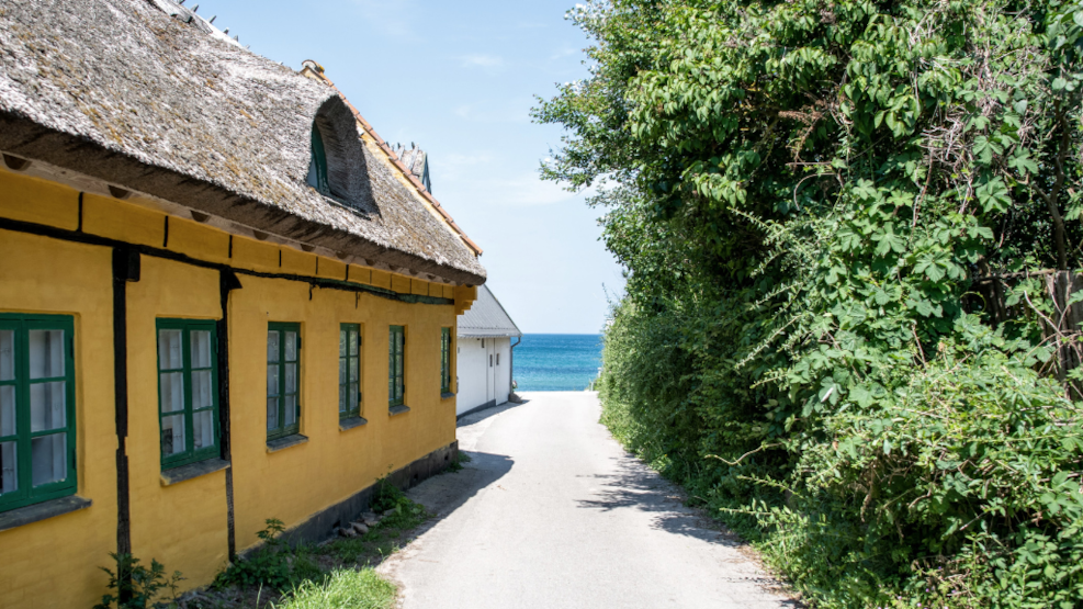
Right on the outer edge of the Halsnæs peninsula, this hike follows part of the Halsnæs Trail from Hundested Harbor through the rugged natural landscape by Knud Rasmussen's house and onwards past Spodsbjerg Lighthouse to the fishing village of Kikhavn. You'll walk through Kikhavn, passing the thatched colourful fishing houses, and follow the road inland towards the Tothaven Visitor Farm.
Through the beech forest, the journey returns to Hundested. This trip is right on the edge of the North Zealand Kings National Park, an 11.5 km hike where nature and culture go hand in hand.
Here's where the journey begins
Upon arrival at Hundested Station, turn left and follow Jernbanegade towards the harbour. Turn right onto the main street Nørregade (signposted). Turn left onto Nordre Beddingsvej. Cross Strandvejen. If you have time for a little detour, turn left and take a stroll through Kajgade, where you'll find cosy artisans and Hundested Sandskulptur Park. Back on track, follow the edge of the harbour basin past the playground and turn left towards the embarkation ramps at the ferry dock.
- If you start the tour at Vibehus Station:
Take the train to Hundested Station—just 1 stop. - If you start the tour at Dyssekilde Station:
Take the train to Hundested Station—3 stops.
Continuing along the beach
Turn right and pass by Havnekiosken, then cross to the left side of the road. Between the dunes and the yellow houses with red roofs, turn onto the path and walk along the beach. If you're planning a dip in the water, this is where you'll find the best beach.
Cross the small parking lot and turn left onto Skansevej (signposted). Up at the fortifications, turn left onto the asphalted cycle/pedestrian path signposted to Knud Rasmussen's House and Spodsbjerg Lighthouse.
You'll pass Skansen, built during the English Wars 1807-14, to defend the entrance to Roskilde Fjord and Isefjorden. Where the path ends, turn left onto Knud Rasmussenvej - stay left onto the gravel road (look for cycle route 47 signposted Nordkystruten - then you're on the right track).
A visit to Knud Rasmussen's House
Visit Knud Rasmussen's House and learn about the polar explorer who worked here between his expeditions to Greenland. Aim for Spodsbjerg Lighthouse and enjoy the view from the top. You'll pick up the gravel path (and Route 47 sign) on the other side of the hill, where you can see to the fishing village of Kikhavn.
Along the water to Kikhavn
Follow the path until you reach the point where the cycle route turns inland - where there are usually a couple of boats on land. But continue along the water on the narrow gravel path. The path ends at a gravel road and a large thatched farmhouse. Turn right onto Kattegatvejen (signposted). Where the road ends, turn left onto Vestre Stræde, later Kikhavnvejen. Be careful, there may be some traffic on the road. You'll pass by the Cafe and farm shop Kig-Forbi.
Tothaven Visitor Farm
Arriving at the main road Nøddebovejen, cross straight over. Here lies Tothaven, a visitor farm with experiences for both young and old. If you plan to visit the farm, it's a good idea to book tickets in advance.
Follow the path into the forest
Continue on Torupvejen and turn into the forest where Tothaven's areas end. There are 2 paths to choose from; if the one on the right looks dry, choose it, otherwise the other can also be used. Both paths end at a wide gravel path, where you turn right. Follow the path, and stay to the right until you reach the parking lot and asphalt road. Cross straight over Ullerup Skovvej (signposted). Pass by the natural playground and follow the path to the edge of the forest. Turn right here.
You'll follow the edge of the forest until the path turns back into the woods, and here you'll walk 50 m along the ditch. Turn left onto the wider forest path. You'll pass by a fenced-in dog park. Turn right and walk between the dog park and a parking lot to the tennis courts. Turn left out of the forest and pass by the bonfire hut, which should be on your right. Continue past the small lake; the path ends at the sports complex parking lot.
Back to the Hundested centre
Walk along the track fence to Stadionvej (signposted). Turn right and walk until the road ends. Here, turn left onto Lille Karlsmindevej (also spelt Ll Karlsmindevej). The road ends in the centre of Hundested, where you turn right towards the harbour on Amtsvejen (signposted). Turn left onto Læssevejen towards the centre and you're back at Hundested Station again.
Tour facts
- Start at Hundested station
- Terrain: Gravel on Spodsbjergstien, and mixed terrain in the forest.
- Length: The tour is 11.5 km long
- The tour is suitable for walking enthusiasts of all ages. Note that if you bring a dog, it's not allowed into Tothaven.
- Signage: The route is occasionally signposted with Cycle Route 47 signs.
- Toilets: There are toilets at Hundested Harbour and if you visit Knud Rasmussen's House and Tothaven.