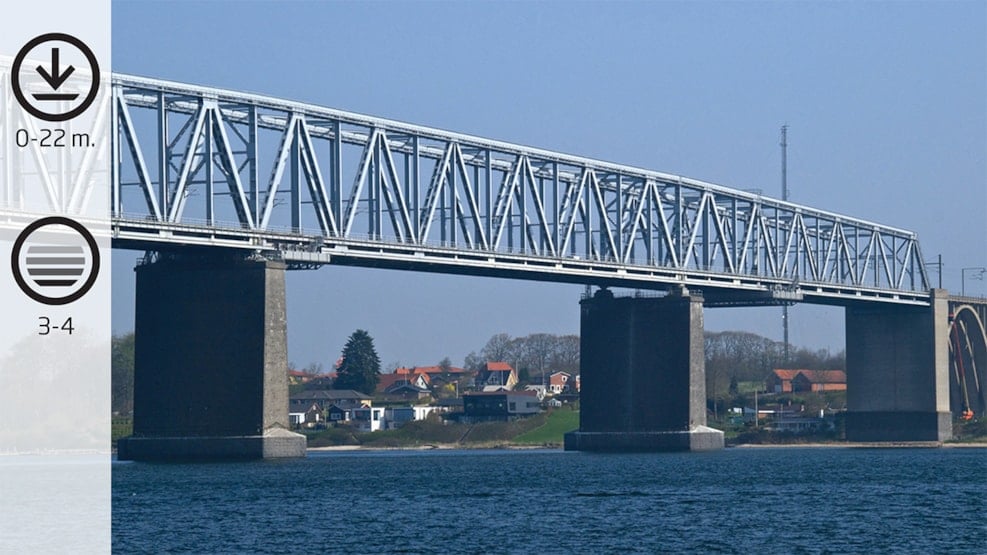
Old Lillebælt Bridge
Beautiful granite bridge pier, overgrown with lots of marine life, such as large cod. Large rocks, overgrown with breadcrumb sponge in orange colours. Mine countermeasure device from the Second World War. A dive with good photo opportunities.
Facts
How to find: Coming from E 20, take exit 59 and turn right at Snoghøj Landevej. After approx. 300 Meters turn left at Snoghøjvej. At the end of this road, turn left at Gl. Færgevej. 100 Meters further along you find the parking space. If you are going out on a boat, you can choose between these slipways.
Geocoordinates:
Longtitude: 9.7103904522
Latitude: 55.51828947
Google Earth Coordinates:
Latitude: 55°31'5.09"N
Longtitude: 9°42'38.98"Ø
Getting in and up the water: If diving from the beach you enter the water from under the bridge, if you dive from a boat, you enter the water from the bridge pier
Highlights: The bridge piers
Air filling station: You can get your airbottle refilled at Hindsgavl Camping in Middelfart (open all year round) during opening times: Hindsgavl Camping.
Best season: from May – September
Dangerous areas: Avoid venturing out into the Belt and please mark visibly with A-flags. Sailing close to the coast during all seasons
Depth: 0-22 M.
Tide: Can be strong in the Belt, but not often strong close to the coastline.
Level of difficulty (1-5): 3-4
Permissions: None
Facilities: parking space and access to toilets (remember coins for the toilets)
Photo opportunities: Good opportunity for wide angle and macro
The Old Lillebælt Bridge
The building of the bridge started in 1925 and ended in 1935. By the inauguration in 1935, the ferry crossing between Snoghøj ended. Through many years the old Lillebælt bridge was part of the most important east-westbound road in Denmark. The old Lillebælt bridge is still one of the most important means of traffic, when coming to the railway traffic between Jutland, Funen and Seeland.
You can dive towards the bridge from the landside or from a boat. The bridge piers are incredible, not only their architectonical appearance but also by their fauna. When you stand under the old bridge and a freight train is crossing, you cannot help looking up and asking yourself:” I wonder how long this bridge will last?”. When you have donned your fins a couple of metres from the coastline, and venture out into a first-class beach dive and another train crosses the bridge, there is no doubt in your mind that you are diving beneath a railway bridge.
If the tide is strong, it can be very difficult to reach the piers, and then the dive has to be from a boat. If you dive for the piers from the beach, you enter the water from Snoghøj at the Jutland side. You enter beneath the bridge and take your compass towards the western corner of the pier. The seabed is very rolling and you pass common eelgrass meadows and beautifully overgrown slopes with sugarkelp. The deeper down and longer out you venture, the more you feel the bridge blocking the light from the sun. It is often a bit darker beneath the bridge, and this can ease navigation. But please note, than your compass will be reacting towards the iron the bridges construction.
The sugarkelp thrives in these tidal waters and you might be lucky to spot an eel beneath one of the larger plants. Not often seen anymore. After a few more minutes swimming, the depth increases, the growth decreases and you will see larger rocks. They are all overgrown with breadcrumb sponge and will seem orange in the light of your lamp. You will often also see larger flatfish. The seabed is a mixture of gravel, stone and sand and behind some of the large rocks, you can be lucky to spot a few cods.
The depth increases and we reach 20 Metres. Soon you will reach the remains of the mine countermeasure devices which were placed here on both sides of all the piers. A very good motive for a photo shoot. Finally you reach the bridge piers, and they are worth all the trouble getting there.
You do not have much time left, if you dived from the beach. But you can manage to pass along the rails, which are still there on the lowest level, only a couple of Metres from the seabed.
The bridge pier is covered in plumose anemones, sea squirts, and, not forgetting, plenty of fishing gear. Towards east and west, the bottom part of the bridge has the shape of the wing of an airplane. When you are at the eastern corner of the pier you reach a depth of 18 Metres. If you choose one of the other bridge piers you can reach a depth of approx. 30 Metres. But such dives must be taken from a boat.